Author: Jason Fredrick
LiDAR, short for Light Detection And Ranging, is a technology that uses lasers to measure distance and create a detailed 3D mapping of the environment. The technology and software has a wide range of uses; from simple imagery to more advanced technical solutions such as self-driving vehicles, robotics, and graphic mapping. Recently, LiDAR has also been used in the maritime industry for detailed inspections, blueprint development, condition monitoring, and alteration planning.
One key benefit of LiDAR to create high-resolution 3D models of vessels. LiDAR scans of a vessel’s structure provides engineers and technicians a product that can be used to identify potential issues. The imagery and measurable products have proven very useful in relaying pertinent information to designers and engineers who do not have easy access to the vessel’s location. LiDAR can also be used to monitor the structural integrity of a vessel over time and detect changes or degradation that may require attention.
Powerful and innovative; LiDAR is a game changing technology with the potential to revolutionize the way vessels are maintained and operated. As technology continues to evolve and become more widely adopted in the shipping industry, we can expect to see even more innovative applications for the future use of LiDAR.
Scanning
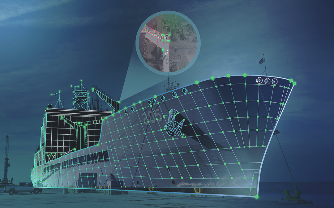
A vessel was recently scanned, incorporating over 700 setup scans and links totaling over 2 terabytes of metadata. The LiDAR metadata product is a valuable resource that is available for Program Managers, Port Engineers, and Designers as a tool for Transportation Alterations (TRANSALTs), Availability Work Items, and space condition monitoring. Figures 1 and 2 show the red setup points and the green and blue links in a 3D image of the vessel. Each scanned point is linked together with software to create a bundled 3D image in which the user can easily navigate.
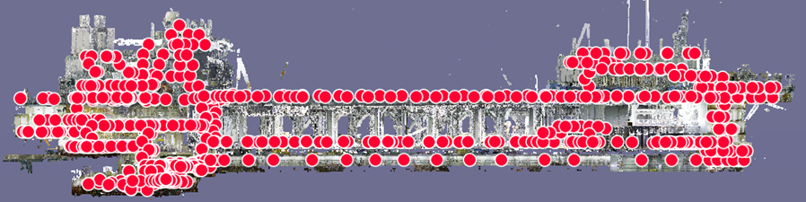
FIGURE 2 – ILLUSTRATES HOW EACH SCAN IS LINKED TO PROVIDE A VIRTUAL IMAGE OF THE VESSEL
As shown in Figure 3, a Leica RTC360 camera featuring a class 1 laser and High Dynamic Range camera is utilized to scan a space. The scanner/camera is controlled by an electronic device such as a tablet, which is being used in this example. The tablet is the first critical step in setting up, naming a particular project, coordinating linked scans and modification of initial links. This combined technology produces 4K imagery with 3D fly through capability for easy viewing with various software-based applications. Once a project is downloaded for software processing, additional links can be created, quality enhanced with imagery manipulation, and adjustments to create a more accurate 3D bundle with a variety of functions. The final product provides the user the ability to measure distances within the imagery to millimeters. The user will be able to determine dimensions of cabling, piping, and equipment. Additionally, you can determine the exact location and positioning of equipment within a space as well as the condition of a space. The final product provides the user with the capability of navigating the vessel as if there were onboard! See Figure 4.
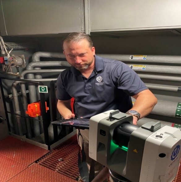
FIGURE 3 – LiDAR CAMERA IN USE

FIGURE 4 – EACH LOCATION THE CAMERA TOOK A SCAN INSIDE A SPACE
Application
Even before COVID restrictions, attempting to visit an operational vessel can be challenging and time consuming. The LiDAR application provides a solution to sending an engineer onsite, where now, the engineer can remotely design equipment upgrade packages with confidence of fit and form. A data warehouse is critical for housing and maintaining all this valuable information for the future. Lastly, this technology can be used for scanning buildings, facilities or manufacturing plants which can also provide a wealth of information and knowledge to a user.